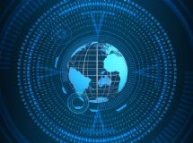
- The Global Positioning System (GPS) was established in 1993, when the last of 24 satellites was launched into orbit. A GPS receiver uses information from at least three of these satellites to triangulate its latitude, longitude and often elevation to identify the receiver's location anywhere in the world.
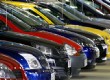
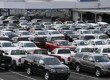
Latitude and longitude measures are accurate within several meters. Elevation measured by GPS mathematics is not as accurate and can fluctuate as much as 150 meters. GPS tracking devices that are made with barometric altimeters are much more accurate for measuring elevation. - Many vehicles today can be purchased with GPS tracking already built into the vehicle. Some include basic mapping devices, while some also have live traffic and road condition updates and gasoline price updates. Some will notify authorities in the case of a vehicle collision.
GPS tracking often is used for fleet vehicles and trailers. Economically, a fleet of vehicles can save money by tracking the shortest routes and by knowing fuel prices. The fleet owners can match driver time and expense reports with tracking data collected for the vehicle. - GPS services also exist for tracking people. Criminals placed under house arrest are given a waterproof ankle bracelet that contains GPS technology. GPS perimeters can be programmed into the bracelet, which will send an alarm it goes outside the established boundaries. If the bracelet is removed, it immediately will notify authorities with an alarm.
Another GPS tool is used to track pace and distance for running or walking. These devices have gotten smaller, so they are easier to wear or carry and have had more features and better receivers built in.
Many cell phones have some GPS technology built into them, but the user must pay into a network system for it to be available. It can include mapping tools, and, with user permission, a phone can be tracked by others. Parents whose children carry cell phones often will enable tracking features to keep tabs on their children.
Cell phones can also be tracked in an emergency. For instance, if a driver comes upon a car accident and calls 911, the cell phone location can assist the emergency operators in sending police and other emergency vehicles. - Geocaching is treasure hunting. The person placing the cache records the GPS latitude and longitude coordinates. The cache can be obvious at that location, or it can be cleverly hidden. It may be an easy walk to find it, or it can involve an all-day, technical hike.
The cache will contain a logbook and pen or pencil and often will contain a collection of small treasures or toys. The treasures are there for trade; if a geocacher takes something out, he is expected to leave another treasure behind.
GPS locations for geocaches are found at Geocaching.com. After a cache is discovered, it is reported online; many cache owners use this to find out about activity at their cache. - GPS also is used in conjunction with atomic clocks to keep timing on wireless data systems synchronized. The timing allows business transaction times to be noted and supports digital radio systems for transmitting data. Timing also is used for hazardous weather reports sent from Doppler weather radar to the U.S. Federal Aviation Administration, assisting air travel. Power companies synchronize the power grids based on time information from GPS signals.
GPS mapping is used for roads as well as in agriculture for mapping farmland. Farmland boundaries, soil sample locations, pest and weed locations and other information can be noted and tracked. This can assist crop dusting and in managing irrigation.
Marine and railroad transportation systems also use GPS information to track ship travel and assist in managing ports. For railroad or commuter train travel, GPS information improves rail traffic flow and keeps scheduling information available.
Military GPS usage includes all of the above systems and more. The U.S. Department of Defense does active tracking of events all over the world.
Global Positioning System
Vehicle Tracking
People Tracking
GPS Tracking for Fun
Other GPS Functions
SHARE


